 The State of Water in the Hill Country

Known for its freshwater springs and wildflowers, the Hill Country has lost many of its springs in the last hundred years.
Major Water Challenge: Water-thirsty vegetation encroaching upon the landscape.
Water Resource Problems: Communities turning to limited surface water sources due to declining quantity and quality of groundwater water. By 2050, population is expected to grow by 70%.
Water Planning Areas: F, K, L, J online map
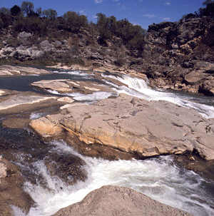
Rising at the Balcones Escarpment, the juniper-and-oak-blanketed Hill Country spreads westward across the Edwards Plateau. This region offers numerous caves, cascading whitewater streams and deep blue reservoirs. It is a land of many springs, stony hills, and steep canyons. The region is also home to a host of rare plants and animals found nowhere else on earth.
The Edwards Plateau, covering 31,000 square miles of central Texas, is honeycombed with thousands of caves. Beneath the eastern edge of the Plateau lies a hidden world of underground lakes known as the Edwards Aquifer. This precious water resource also is home to a number of curious creatures, such as the blind salamander. Today, the Edwards Plateau is characterized by oak and juniper, however grasslands and savannahs were more common in pre-settlement times than they are today.
The Llano Uplift is also known as the central mineral region. Although surrounded by the Edwards Plateau region, the 5,000 square mile Llano Uplift is distinguished by its unique geology. Home to some of the oldest rocks in Texas, the central mineral region contains unique minerals and rock formations. This region is characterized by rock outcroppings and large granite domes such as Enchanted Rock near Fredericksburg. Soils here are predominantly coarse textured sands, produced from weathered granite over thousands of years.
Spring-fed wetlands are pools and seeps (places where water oozes from the ground) shaped by rock, soil and rainfall. Rainwater slowly drains through limestone layers into underground water reservoirs or aquifers. The Edwards Aquifer, just one of several aquifers in Central Texas, provides drinking and irrigation water as well as recreational opportunities for millions of people. Springs occur where faults, fissures and other cracks in the limestone allow the water to reach the surface.
Many of the streams that run swiftly through the rocky, tree-shaded hills of Central Texas are fed by springs. These streams are home to many species of fish, amphibians, plants and insects, which depend on a steady flow of clean water for survival. Some of these species (salamanders in particular) are found only in these spring-fed environments. Our state fish, the Guadalupe bass, is found in several streams and rivers of Central Texas.
Riparian areas are also a common wetland type in Central Texas and offer food and cover for wildlife. Native vegetation consists of oak-hickory or oak-juniper woodlands, mesquite-mixed brush savannah, and grasslands. Open grassland and savannah were once more common than they are today.
Water Supply and Demand
Supply
Major Rivers:: Colorado, Guadalupe, Nueces,
Major Aquifers: Edwards, Carrixo-Wilcox
Use & Demand
- 61% demand met through surface water.
- 65% demand is municipal, 27% irrigation.
- By 2050, population is expected to grow 70%. Municipal water use is expected to rise to 74% for manufacturing, with irrigation falling to 19%.
- Increased demands for groundwater and water quality continue to be a concern. (Source: Texas Center for Policy Studies. Texas Environmental Almanac (Austin: U.T. Press, 2002), 23-28.)
Major Cities - Rainfall / Elevation
Regional Average Rainfall: 15-34 in./yr
Regional Average Net Evaporation rate: 16-32 inches
Elevation ranges from 500 to 2,250 feet above sea level. Data source: National Climate Data Center, U.S. Dept of Commerce.
Austin - 33.65 in. / 621 ft.
Big Lake - 18.79 in. / 2,690 ft.
Blanco - 34.75 in. / 1,370 ft.
Boerne - 37.36 in. / 1,444 ft.
Brackettville - 22.79 in. / 1,118 ft.
Brady - 27.63 in. / 1,720 ft.
Camp Wood - 27.99 in. / 1,470 ft.
Del Rio - 18.80 in. / 999 ft.
Fredericksburg - 31.65 in. / 1,685 ft.
Junction - 23.24 in. / 1,747 ft.
Rocksprings - 24.76 in. / 2,400 ft.
San Saba - 27.72 in. / 1,195 ft.
Sonora - 22.40 in. / 2,138 ft.
